tfClamp
tfClamp constrains a height field between two altitude levels by scaling or clipping it.
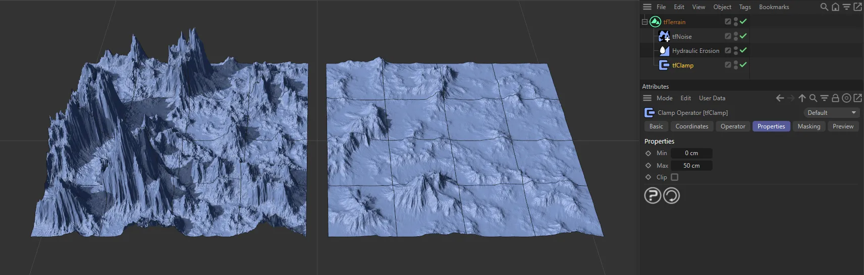
The terrain on the right has tfClamp enabled, scaling the terrain between the Min and Max settings.
Properties
Section titled “Properties”Sets the minimum altitude of the terrain.
Sets the maximum altitude of the terrain.
Any deformation in the terrain will be scaled within the limits of the Min and Max altitude settings.
If this is enabled, the terrain will be clipped to the defined range and any part of the scene that is outside of the Min and Max settings will be clipped, as seen in the image below.
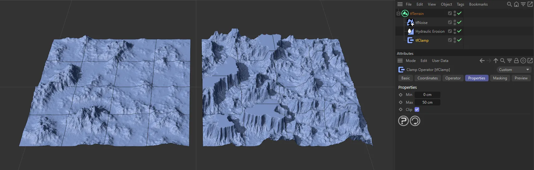
With Max set at 60cm, all areas above the Max of 50cm have been clipped, resulting in flat plateaus.
Copyright © 2026 INSYDIUM LTD. All rights reserved.